Time: 8:00 AM - 10:00 PM
It’s time to turn the volume up to 111!
The Pisgah 111 is the quintessential crusher of a cross-country endurance MTB race. Racers follow a 65.1 mile course with 10,200′ feet of climbing along the most iconic trails and gravel roads known in Pisgah National Forest. Just peek at the course map and list of trails and you’ll immediately get chills just thinking about the epic scenery and terrain you’ll encounter.
This is a true mountain bike race with no map reading skills required, just follow the arrows. Think of it as the most exciting (and grueling) tour of Pisgah you can imagine during the peak of the leaves changing in the forest.
It certainly wouldn’t hurt to study the map and cue sheets to know what you’re getting yourself into, as some of these trails will test your lungs and your legs while the scenery blows your mind.
There will be FOUR rest areas (at three locations) along the way that will be stocked with water, food (PB&J, fruit, salty snacks, sweet snacks, bars), first aid, and neutral mechanical support. Riders may send drop bags to each rest area. Be sure to read the information below, too.
Not enough racing for you? Register for the entire King and Queen of Pisgah series!
Course:
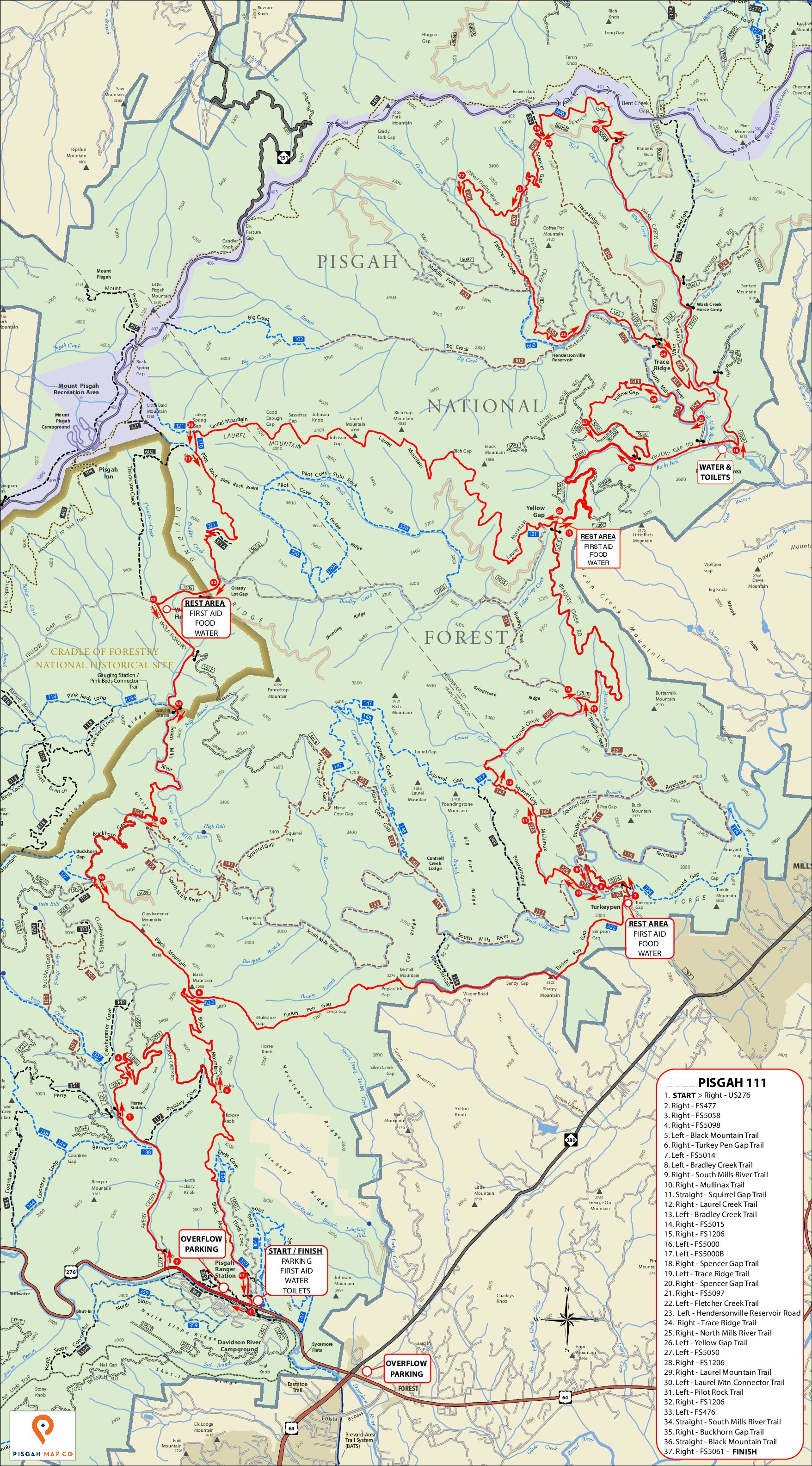

Downloads of the course map and .gpx track are available at the bottom of this page.
Schedule of Events:
Friday 5PM-10PM – SIGN-IN OPEN
Saturday 5:30AM-7:30AM -SIGN-IN OPEN
Saturday 7:45AM – Mandatory Racer Meeting
Saturday 8AM – Race Start
Saturday 10PM – Race Final Cutoff
Rules:
1. Have Fun!
2. Cyclists must wear an approved cycling helmet at all times while on the bike.
3. Racers may receive support from other participating racers while on course.
4. Racers may NOT receive outside support while on course.
5. Racers must stay in single-file except to pass.
6. Racers must obey all local traffic laws.
7. Electric-Assist bikes (E-Bikes) are prohibited.
8. Racers must use a front light (250 lumen minimum) after 7:00PM.
9. The Race Director reserves the right to disqualify any rider for any reason.
Venue:
PARKING:Directly across US 276 from Davidson River Campground.
1 Davidson River Circle
Pisgah Forest, NC 28768
OVERFLOW PARKING:
Pisgah Ranger Station
1600 Pisgah Hwy - US276
Pisgah Forest, NC 28768
Follow the signs and walk/ride from PARKING to the SIGN-IN and START/FINISH area.
Directions:
From Asheville, North Carolina, take I-40 West to I-26 East to Exit 40 (Airport Road/Asheville Regional Airport), onto State Highway 280. Continue south 15.5 miles on 280 to Pisgah National Forest. Turn right at the intersection of Highway 280/64/276. Go north on 276 for 1 mile. Follow signs to Davidson River campground.
From Spartanburg, South Carolina, take I-26 West to Exit 40 (Airport Road/Asheville Regional Airport), onto State Highway 280. Continue south 15.5 miles on 280 to Pisgah National Forest. Turn right at the intersection of Highway 280/64/276. Go north on 276 for 1 mile. Follow signs to Davidson River campground.
From Charlotte, North Carolina, take I-85 South to Gastonia and exit at U.S. Highway 74 West. Merge with I-26 West to Exit 40 (Airport Road/Asheville Regional Airport), onto State Highway 280. Continue south 15.5 miles on 280 to Pisgah National Forest. Turn right at the intersection of Highway 280/64/276. Go north on 276 for 1 mile. Follow signs to Davidson River campground.
Other:
REQUIRED GEAR:
Every racer will be required to carry the following at all times while participating in the event:
1. Mobile phone
2. Light source (250 lumen minimum)
3. Rain jacket
There will be a required gear check at sign-in. Please have your gear ready for inspection.
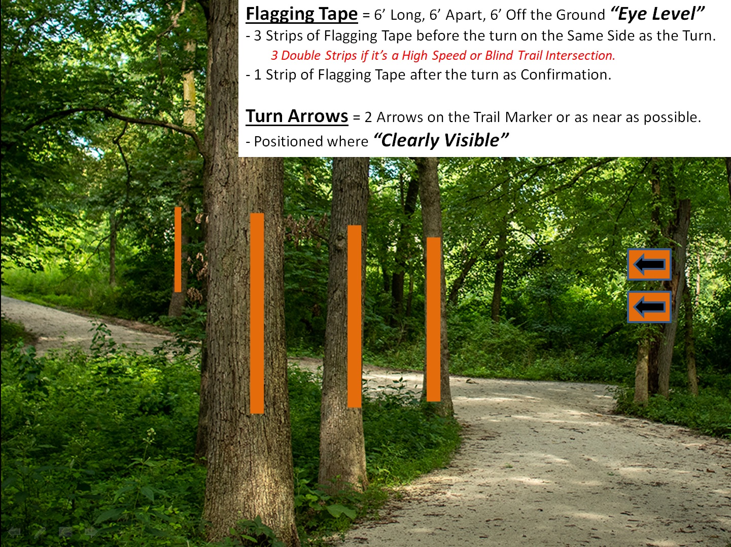
COURSE MARKING:
OTHER:
- PARKING:
Directly across US 276 from Davidson River Campground.
1 Davidson River Circle
Pisgah Forest, NC 28768OVERFLOW PARKING:
Pisgah Ranger Station
1600 Pisgah Hwy – US276
Pisgah Forest, NC 28768Follow the signs and walk/ride from PARKING to the SIGN-IN and START/FINISH area.
There are also other parking lots in the area especially near the intersection of NC280 and US276. Be aware of posted no parking areas. Please be resourceful and respectful.
- Rest Areas will be located at Turkey Pen Parking Area (Mile 13.5), FS1206 at Yellow Gap (Mile 22.1), FS1206 at Yellow Gap x2 (Mile 44.1) and FS1206 at FS476 (Mile 53.7). Rest Areas will be well stocked with plenty of water, snacks, and other neutral support.
- Drop-bags may be sent to each of the rest areas. Please limit the size of your drop bag to a one gallon zip lock bag per rest area (approximately two large water bottles).
- All roads used in the Pisgah 111 will be OPEN to vehicle traffic. Please use common sense while on gravel roads. Stay to the right. Do not cut corners. Pass with care. Ride single file.
- This event is under special use permit with the U.S. Forest Service.
LODGING:
REFUND POLICY:
Sorry, No refunds.
RIDEWITHGPS.COM link:
https://ridewithgps.com/routes/49423203
Route Downloads:
Pisgah 111 -- Map (map/cue is in the .zip file)
GPS Downloads:
Pisgah 111 -- GPX (gpx is in the .zip file)
Sponsors:


Sponsors:
 2023 Pisgah 111 / 555 photos
 2021 Pisgah 111 photos
 2019 Pisgah 111 photos
 2018 Pisgah 111k – photos
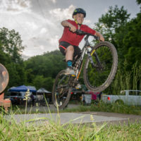 2017 Pisgah 111K photos
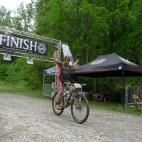 2016 Pisgah 111k photos
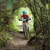 2015 Pisgah 111K photos (Icon Media Asheville)
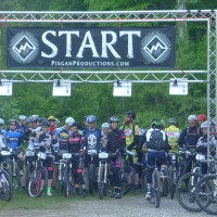 2014 Pisgah 111 photos
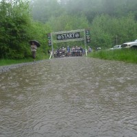 2013 Pisgah 111K photos
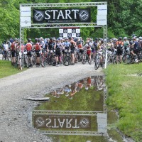 2012 111K photos